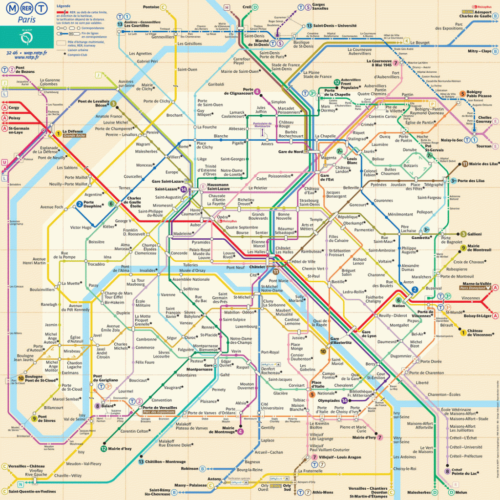
The Paris metro is one of the public transport systems serving the city of Paris and its agglomeration. Operated by the Régie Autonome des Transports Parisiens (RATP), it comprises sixteen exclusive right-of-way lines, mostly underground, totaling 219.9 kilometers. It has become one of the symbols of Paris, characterized by the density of its network in the heart of Paris and by its homogeneous architectural style influenced by Art Nouveau. In 2009, the metro carried about 4.05 million passengers per day (1.479 billion per year). Traffic details are available on this page: Paris Metro and RER traffic in 2011
The first line of the Paris metro was built in the run-up to the 1900 Universal Exhibition. It was inaugurated a few months after the beginning of the exhibition. The network then rapidly grew in density in Paris until the Second World War. After a pause during the “car decades” (1950-1970), several existing lines were extended to the inner suburbs. The choices made at the time of design (short distances between stations, reduced train capacity) now limit the possibilities of extending the network. However, at the end of the last century, the Paris metro inaugurated a new fully automated line, line 14, designed to relieve the pressure on line A of the RER. Line 1 was automated and secured in 2013, as was line 14.
Other public transport services are also available in Paris and its suburbs: the Réseau express régional d’Île-de-France (RER) (451 million passengers in 2006 on the RATP RER network), the Transilien (suburban train network, 655 million passengers including the SNCF RER network), five exclusive right-of-way tramway lines (85 million passengers in its 2006 configuration), the bus network (997 million passengers in 2006) as well as three lines using a light automatic vehicle (VAL) and providing local service to airports.
